Hiestands Move to the Shenandoah Valley in Northern Virginia
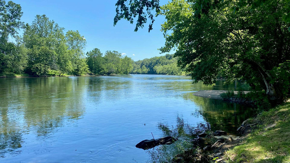
Our Daniel Hiestand/Haston was probably born a quarter mile or less down river from this spot. He grew up here and no doubt learned to swim and fish in this river--the South Fork of the Shenandoah River--very near what is now the Bixler Bridge in Page County, VA. The photographer of this picture was standing on land once owned by Henry Hiestand.
Do you like to camp? You can do that here for $50 per night.
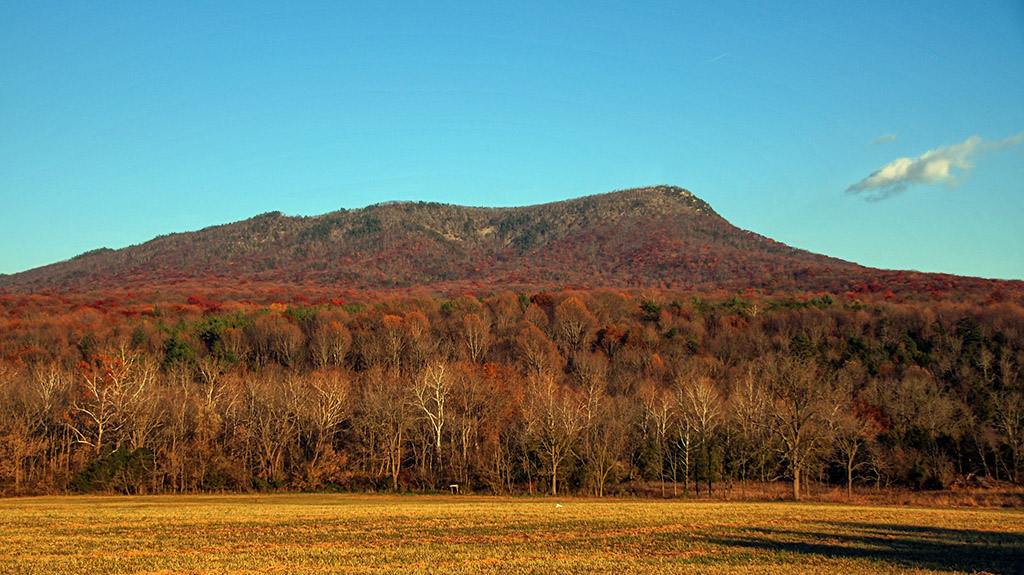
About 30 miles south into Virginia from Pennsylvania, the Massanutten Mountain which reaches an altitude of nearly 2,000 feet at several points emerges sharply east of Strasburg and west of Front Royal. The Massanutten Mountain divides the Shenandoah Valley for 50 miles before ending just as sharply near Harrisonburg on the west and Elkton on the east.
The Massanutten Mountain is an isolated wedge of mountain.
John Wayland, Shenandoah Valley Historian
Massanutten Settlement
About the time Henrich Hiestand was arriving in America, some of his future Virginia neighbors were already beginning to settle near the Massanutten Creek on the lower part of the east slope of the Massanutten Mountain in what was then Spotsylvania County, Virginia. Adam Mueller (Miller), Abraham Strickler, Mathias Selzer, Philip Lung (Long), Paul Lung (Long), Michael Rhinehart, Hans Rood (John Rhodes or Roads), Michael Kaufman—all from Lancaster County, Pennsylvania—had purchased land there from Jacob Stover in about 1729. But, they were likely squatting on the land two or three years earlier.[i] It was the first white settlement west of the Blue Ridge Mountain.
[i] Harry M. Strickler, Massanutten Settled by the Pennsylvania Pilgrim, 1726. (1924; reprinted, Markham, VA: Yesterday Books, 2009), 26-27.
While still attempting to secure a grant of 5,000 acres in the wilderness of Spotsylvania County, Swiss-German immigrant Jacob Stover (Stauffer) from the Lower Salford area near Skippack in eastern Pennsylvania sold tracts of his hoped-for grant to several incoming settlers from Lancaster County.
These 5,000 acres have since been known as the Massanutten Patent[i] or the Massanutten Tract, or the Massanutten Settlement. This irregularly shaped tract began near Alma, Virginia on the south end and continued northerly about ten miles to the mouth of the Hawksbill Creek, which is about three miles north of what is now the town of Luray, spanning the South Fork Shenandoah River along the way. Strickler noted that “the patent took in only the better river bottomlands and skipped the rough bluffs at the bends of the river.”[ii] Later, when Lord Fairfax began selling his proprietary lands, he disallowed such a selective process by requiring that each tract had to be “laid out so that its breadth was no less than one-third of its depth.”[iii]
[i] “Jacob Stover’s Patent for 5,000 Acres,” Virginia Patent Book No. 15. (Richmond, VA: Land Office), 129.
[ii] Strickler, Massanutten Settled by the Pennsylvania Pilgrim, 1726, 121.
[iii] J. Ross Baughman, Some Ancestors of the Baughman Family in America. Edinburg, VA: Shenandoah History Publishers, 1994), 28.
A Book I Highly Recommend
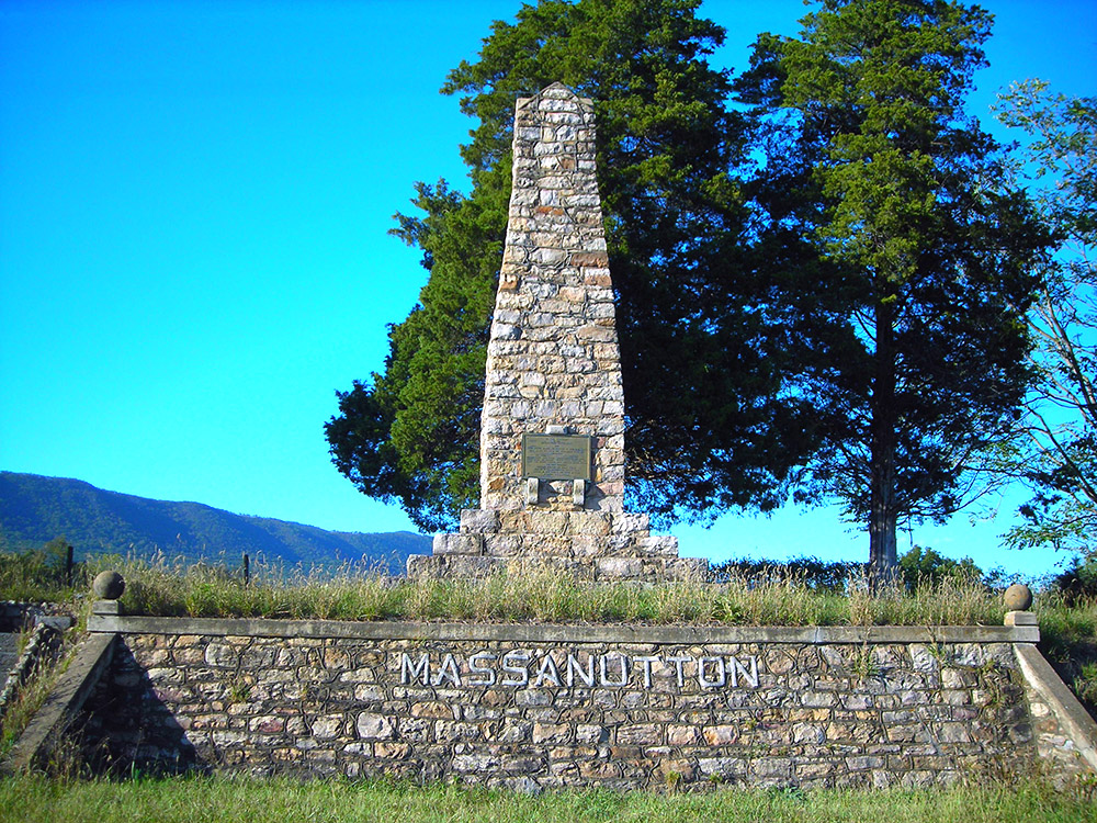
In 1929, a group called the “Massanutten Society” erected a monument in the heart of the original Massanutten Tract to honor the earliest families of the Massanutten Settlement who planted their roots there about 200 years earlier. The monument is located west of the White House Bridge on the west bound side of Highway 211, less than a mile from the river.
Hiestands Join the Massanutten Settlement
When Henry purchased his South Fork Shenandoah River tract, he became the third (other than Jacob Stover) private owner of his chunk of the Massanutten Patent. But he was probably the first white person to actually settle on this land. Stover deeded parts of the 5,000 acres to six men in 1735 and 1737. More than 40% of the acreage went to Ludwick Stone, 1100 acres on December 15, 1735 and another 1050 acres on November 24, 1737. A few months later…
- Ludwick Stone sold the 1050 acres, in two separate tracts (800 acres and 205 acres), to…
- Philip Long for 100 pounds on March 1737, who then, six and a half years later, sold the “by estimation” 205 acres tract to…
- Henry Hiestand for 54 pounds, 16 shillings, 6 pence on September 22, 1743.[i]
[i] Orange County, Virginia Deed Book 7, 419-420.
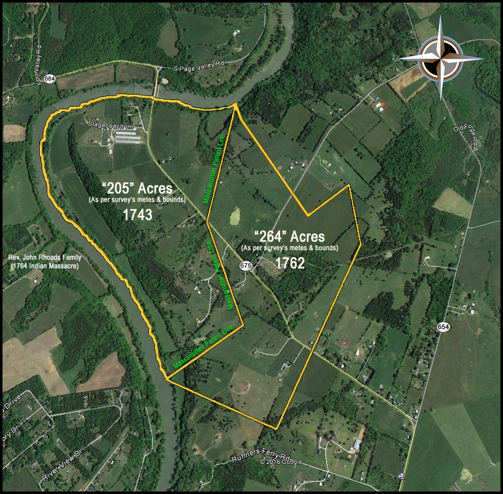
But 800 acres plus 205 acres does not add up to 1050 acres for the second tract Long purchased from Stone, so why the discrepancy with the number of acres? Surveys in those days were often quite inaccurate and this seems to be the case with this transaction. When you plot the “metes and bounds” for Henry’s survey, it appears that he actually received about 310 acres, yet the survey says, “by estimation two hundred and five acres of land.” Perhaps the fact there were nearly two miles of bending riverfront explains this large of a discrepancy. It must have been quite difficult, in those days, to survey bending river frontage accurately.

Notice that the dog-legged east line is the Massanutten Patent Line, so the Hiestands were just inside the historic Massanutten Tract.
Was Henry’s newly purchased land in Virginia that much better than the Hempfield Township tract in Lancaster County? The land surveyed for Henry in Pennsylvania was good land—rich and level. The stream that ran across a corner of the Lancaster County property was probably an adequate water source, especially at the time Henry owned the rights to the land. Although much of the Shenandoah River tract was hilly and the soil may have been quite thin in some places, there was about 1.8 miles of river frontage, with about 40 acres of very rich river bottom land, assuming the land has not changed too much in nearly 300 years. Was the river frontage and the bottom land on the South Fork Shenandoah River worth that much? Probably it was for a pioneering SWISS-German farmer.
Although Henry later acquired other land in Virginia, one adjacent tract and a Massanutten mountain tract, this river front property was no doubt his home place from then on—the place where at least his three youngest children (including our Daniel Hiestand/Haston) were probably born. This Shenandoah riverfront property had most everything a pioneer farmer would need or want:
Easy access to water, reliable year around—nearly two miles of frontage on the South Fork of the Shenandoah River, an abundant supply for his animals, as well as his family, as well as a stream that was said to provide a plentiful supply of fish.
Plenty of land for pasture and woodlands, as well as sunny-side hills for orchards.
Limestone soil, with its enviable inherent soil conditioner, which Mennonite farmers highly valued.
- Several acres of rich river bottom land for crops, much of which may have already been cleared or easy to clear.
Today, approximately 40 acres of flat, rich-soil river bottomland exists along the river at the site of what was Henry’s homestead. (And you can camp on it!)
Dr. Wayland’s following description of a German settler’s ideal land almost sounds like a description of Henry’s South Fork of the Shenandoah River acreage:
The German pioneers followed the chief watercourses of the Shenandoah Valley, and fixed their settlements for the most part on or near the fertile bottom lands along the larger streams. In these localities the soil was most productive and most easily worked; and the lay of the land was generally most desirable. At many places there would be a wide bottom on one side of the river, sweeping out in an almost level expanse for a mile or more, even though on the opposite side of the stream, at that particular point, there might be an abrupt bluff. Frequently, too, there was but little timber to clear away on these broad levels. Along the banks of the stream there were always trees of a larger or smaller growth; but it is quite probable that many of the best lowlands were still largely prairie.
Henry's Additional 264 of River Land
Henry did not yet have a warrant for this land, but on July 11, 1752, he had “264 acres on the south side of South Fork of Shannadoah” surveyed. This acreage was adjacent to John Bumgarner and the “line of old Messnuttin Tract,” which was a border of Henry’s 205+ acres. The deed for this new tract was entered on August 2, 1762 and that length of time was not uncommon for that era in that location.
If you enjoyed this article, please share it with others who might be interested.


One thought on “09 – Our Ancestor Moves to the Shenandoah Valley, VA”
Thank you so much for all of your hard work on these articles. I really enjoy reading them and learning from them. Hopefully this spring, I can go to Lurray county virginia and see these areas. I don’t live very far away.