Two of Daniel Haston's Siblings in South Central, KY
Abraham Hiestand's (Hestand's) Path Ends in South Central KY
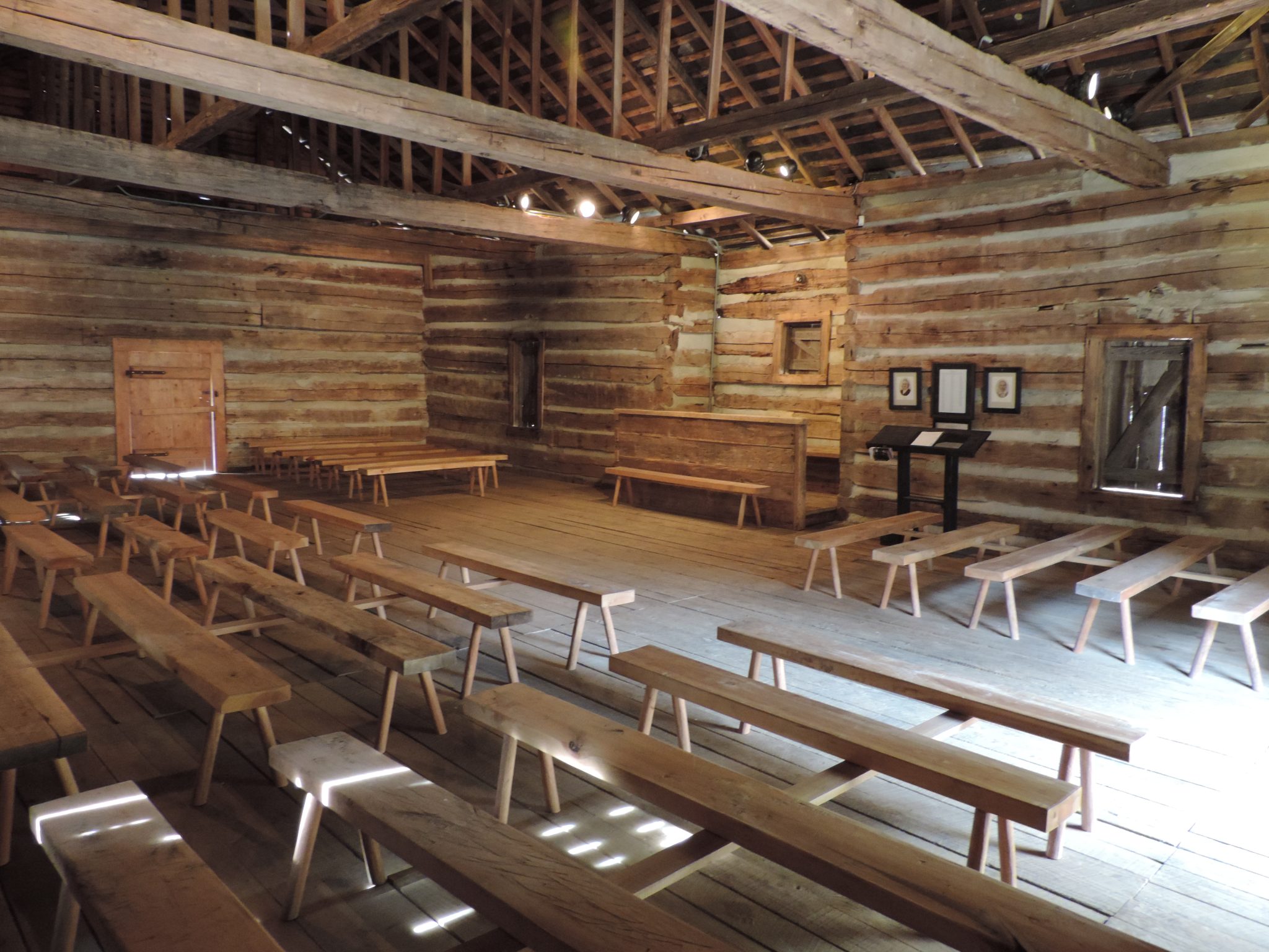
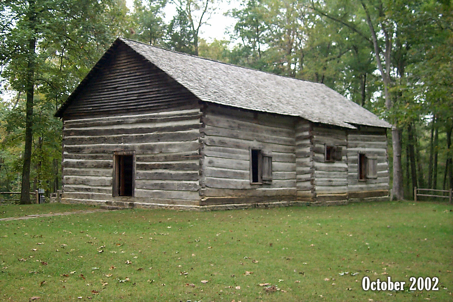
John Mulkey and his brother Philip Mulkey, sons of Rev. Jonathan Mulkey, were members of the Big Pigeon Baptist Church near what is now Newport, Tennessee while Abraham Hiestand/Heaston and his family were members there. They served together in some church business assignments. In the fall of 1797, the Mulkeys left the Big Pigeon church and moved to what is now Monroe County in south-central Kentucky, where they planted the Mill Creek Baptist Church, near Tompkinsville, KY, as well as several other branch churches in that area.
A few months later, March 31, 1798, Abraham also moved to Kentucky. Prior to 1797, the area south of the Green River in KY was reserved for Virginia’s Revolutionary War veterans. But in 1797, anyone over 21 years old could claim land there. “Such persons were entitled to not less than 100 acres or more than 200 acres, but must have been bona fide settlers on the land for one year before they became into actual possession.”
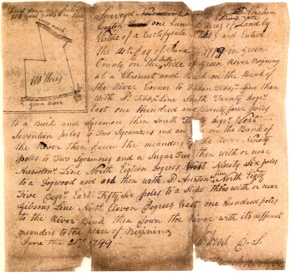
Abraham staked his claim on 200 acres, but only had 100 acres surveyed. However, it was not near Mulkey’s church–it was on the Green River, about 40 miles north of Tompkinsville, KY.

Abraham's 100 Acres Survey on the Green River
This tract is near Campbellsville, KY in Taylor County. Notice the boundary with “Tibb’s Line.” In the Civil War the Battle of Tebb’s Bend was fought at that site. An adjacent bend in the Green River is known as Lemon’s Bend. It is named for John Lemon, a longtime acquaintance of Abraham.
For some reasons, perhaps the death of his first wife, Abraham never finalized the claim to his 100 acres on Green River. Instead, he chose to live in Monroe County (actually, Barren County until 1820) and joined the Mill Creek Baptist Church.
The Mill Creek Church Split

The Mulkey brothers were sons of Jonathan Mulkey, a famous pioneer Baptist preacher in western North Carolina (East TN). But Pastor John began to develop some doctrinal views that concerned some members of the Mill Creek Baptist congregation. Those concerns escalated to the point that the church split on November 11, 1809.
It was while a representative number of the church were attending and a proposition was made that those who endorsed Mulkey’s doctrine were to walk through one of the doors of the building, and all who opposed the doctrine of Mulkey were to walk out the other door of the building. The proposition also was made to count the members who followed each deacon out and the deacon who had the largest number of members, he and his members were to retain the building. The count disclosed that those who favored John Mulkey drew a majority and thereby gained possession of the building.[i]
[i] Cawthorn and Warnell, 437.
John and Philip Mulkey went on to become prominent leaders in what became known as the Restoration Movement, which generally centered around the theology of Barton Stone and, later, Alexander Campbell.
The Baptist minority from the Mill Creek congregation who refused to follow Mulkey’s theological direction found themselves (literally) standing outside without a meeting house. “They proceeded to purchase one and one half acres of ground from John Harris, on which they erected a new “Mill Creek” building.
Out of which door did the Hestands exit? Subsequent records indicate that Abraham Hestand and, his son, Daniel Hestand remained faithful to the Baptist roots they had put down in Virginia and nurtured during their years in eastern Tennessee. They broke ranks from their old friend, John Mulkey, and joined the new Mill Creek Baptist Church.
Hestand, Kentucky
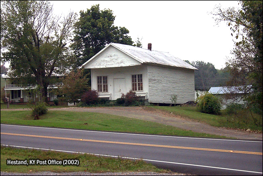
Abraham Hiestand’s family took root in South Central Kentucky. The Hiestand name became Hestand. And a community in southern Monroe County was named for them. A post office was established there in 1888.
Daniel's Youngest Sister and Brother-in-Law, the Gimlins
Andrew and Mary Magdalene Hiestand Gimlin Near Harrodsburg, Kentucky
Daniel’s little sister, Mary Magdalene Hiestand, married Andrew Gimlin on December 5, 1773. Less than three years later, Andrew was in Kentucky (which was a western territory of Virginia at the time) raising corn and building a cabin. Although the law was not enacted until 1779, apparently there were rumors of a “Corn Patch and Cabin Rights” law in the works in the Virginia legislature. The law stated: “Every settler who had occupied a tract and had raised a crop of corn [in Kentucky] before January 1, 1778, was entitled to 400 acres at the price of $2.25 per 100 acres and was allowed the further right to pre-empt an additional 1,000 acres at $40.00 per hundred acres.”[i]
[i] Willard Rouse Jillson, comp., The Kentucky Land Grants, Part 1. (Baltimore: Genealogical Publishing, 1991), 3-5.
Andrew certainly must have anticipated this law when he visited and planted corn there in the summer of 1776 (when the Declaration of Independence was signed!). Virginia Land Commission Records for 1779-1780 state:
Andrew Gumlin this day [January 28, 1780] claimed a settle’d and preemption to a tract of land in the District of Kentucky on acc’t of raising a crop of corn in the County in the year 1776 lying on the north side of Dicks (Dix) River about 1 miles E of James & Edmund Arches land to include his improvement. Satisfactory proof being made in the Court the commissioners are of the opinion that s’d Gimlin had a right to settlement on 400 acres of land to include the s’d improvements & and the preemption of 1000 acres of adjoining & that a Cert. Issue accordingly.[i]
[i] Kentucky Historical Society, Certificate Book of the Virginia Land Commission, 1779-1780. (Greenville, SC: Southern Historical Press, 1981), 151.
This was the Daniel Boone and James Harrod Era in Kentucky!
Andrew and Magdalena Gimlin were definitely the most adventuresome members of the Henry Hiestand family. Their area of central Kentucky was not safe from Indian attacks for another twenty-five years or so after they settled there. The Gimlins were entering the northern part of what Cherokee Chief Dragging Canoe predicted in March 1775 would be “a dark and bloody ground” if white settlers took their hunting grounds away from them. Chief Dragging Canoe’s prediction came to pass, just like he promised. Wisely, Andrew and Magdalena settled near Fort Harrod where they could flee for protection during impending Indian attacks.
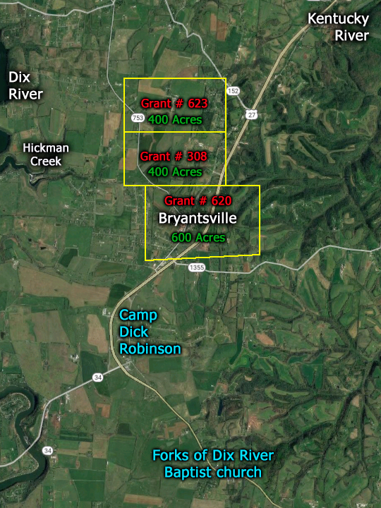
Andrew Gimlin’s first recorded appearance as an abiding settler in Kentucky was on January 28, 1780. Andrew probably arrived in Kentucky before the 1779-1780 winter and a few months later began to acquire the 1400 acres he was qualified to own because he had been there and raised a crop of corn and constructed some kind of shack in the summer of 1776. [i]
[i] Andrew Gimlin, Early Certificates of Settlement and Preemption Warrants in Kentucky County, Virginia. January 28, 1780.
Unfortunately, no stories of the Gimlin’s adventures while living between the Dix and Kentucky Rivers have been passed down to us. But enough has been recorded about life (and death!) in and around Fort Harrod (Harrodstown/Harrodsburg) and Fort Boonesborough (50 miles to the east) to inform us that Andrew Gimlin and his family must have suffered much during their 20-plus years there.
Boundary disputes and lawsuits, due to the poorly managed disbursements of grants and sloppy surveys soon plagued Andrew Gimblin and many of the other Kentucky settlers. Eventually, the Gimlins moved farther south to Cumberland County, Kentucky.
Where did they settle in Cumberland County, Kentucky? On the 1810 Federal Census for Cumberland County, Kentucky Samuel, David, and Molly Gimlin’s names appear on the same census roll as three of Abraham Hiestand’s sons: Abraham Hastings (Jr.), Henry Hastings, and Daniel Hastings. Molly’s name appears just 48 names above the Hastings cluster of names.[i] We know from other records that the Gimlins and these Hastings/Hestands lived in the southwestern corner of Cumberland County that became the southeastern corner of Monroe County, Kentucky in 1820. They did not live far apart and, no doubt, the two siblings of our Daniel Haston reconnected!
[i] Year: 1810; Census Place: Burksville, Cumberland, Kentucky; Roll: 9; Page: 176; Image: 00185; Family History Library Film: 0181354
Fort Harrod - Where the Gimlins Probably Fled in Indian Attacks
If you appreciated this article, please share it with others who might also enjoy it.

